Explore the best walks in Cornwall along the South West Coast Path with our complete guide. Discover scenic hikes to hidden beaches, dramatic cliffs, historic landmarks, and charming coastal villages, plus tips on parking, walking times, and local highlights.
Updated in August 2025
Spending time in nature has been proven to support human health both physically and mentally. After months of lockdown, we developed a stronger connection to nature and a greater appreciation for what it can offer.
Time outdoors allows you to destress and reconnect with yourself. Some of our best conversations and ideas have happened while walking. It allows our bodies to switch off, and walking has been proven to release endorphins, which help us relax and improve our mood.
If you’ve been sitting for too long or binge-watching Netflix recently, maybe you could benefit from getting outside and breathing in some fresh air because you’ll feel so much better, we promise.
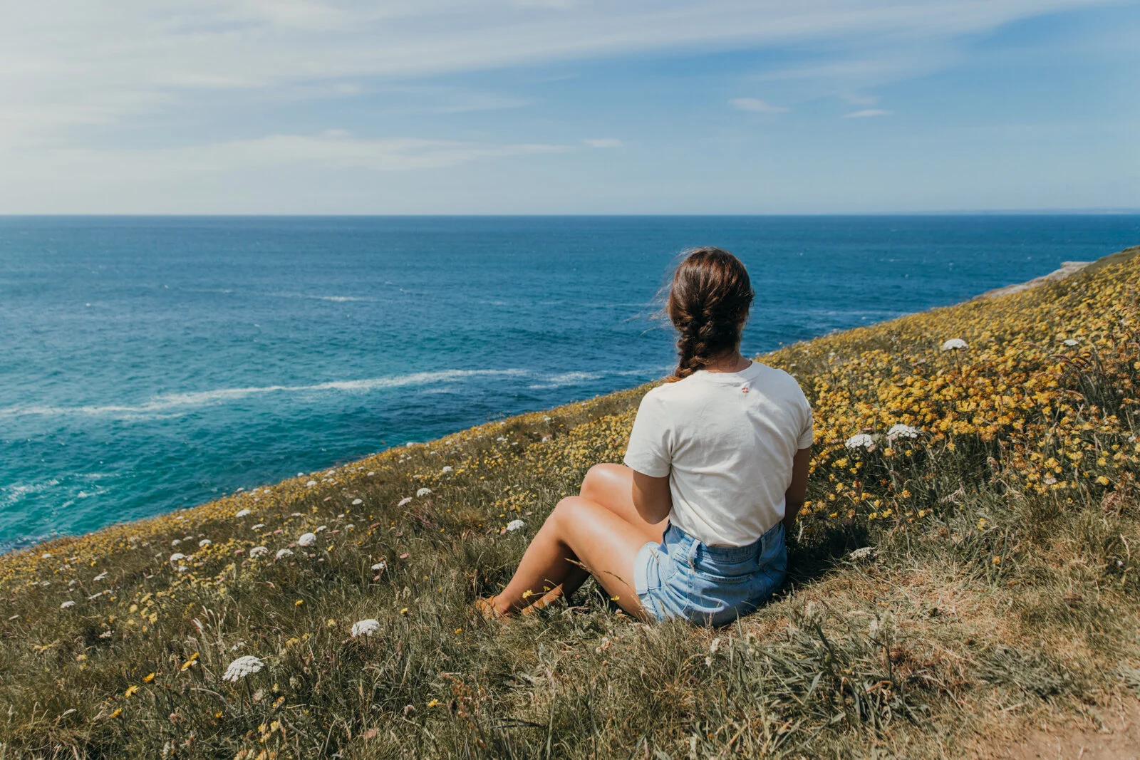
We’ve put together a short list of some of our favourite hikes along the South West Coast Path in Cornwall. The path is 630 miles long, starting in Minehead, Somerset, and finishing at Poole Harbour in Dorset.
After reading The Salt Path by Raynor Winn, the book brought this spectacular route to light. You can walk the whole stretch, but it will most likely take you 7-8 weeks (the current record is just over 10 days!). Cornwall’s beaches can get busy during the summer at popular spots; however, if you’re willing to find some hidden gems, putting in the effort might reward you with having them all to yourself!

Important tip: Always check the tidal times
Tidal times indicate when the tide will be high and low during the day. In some cases, this means the beach at low tide has plenty of sand to explore, but at high tide, there might be no beach left at all.
Tidal times change throughout the year and are not the same every day, which makes it very important to check them, especially on non-lifeguarded beaches, where extra care is needed. Before you set off on your hike, we recommend searching for tidal times online via the Met Office. Please remember to wear appropriate footwear and bring plenty of water and food with you.
Another useful tip we found for Cornwall is to purchase a National Trust (NT) membership, as many car parks are owned by them. Some of these car parks are included in the list below and could be worthwhile if you plan on visiting any NT sites. The membership costs about £6 a month, which is cheaper than the cost of all-day parking at a single site, so it may be worth it depending on your plans.
Most of these routes are one-way, and some locations have nearby bus routes, which we’ve indicated below if available. This will require planning to ensure you can catch the last bus back, or you might consider taking the bus to the start and walking back. I suggest taking the bus there and walking back, so you don’t have to rush your walk to catch the bus.
Poldhu beach to Mullion Cove, Lizard Peninsula
Length | 6km
walking TIME | allow 2hrs
This walk is located within the Lizard Peninsula, which is sprinkled with beautiful coves and beaches along the coastline. The Lizard is designated as an Area of Outstanding Natural Beauty (AONB) and is one of the few places where you can spot some of Britain’s rarest plants.
The walk itself is relatively easy, although there are a few steep parts, so we recommend wearing suitable footwear. Our route was not circular, and we started and finished at Poldhu Beach. Alternatively, you can start from Mullion Cove. There are regular buses that operate along this route between Poldhu and Mullion.
We parked in the Poldhu car park, which is a decent size and owned by Cornwall Council. There is a beach café and shop right on the beach that sells hot drinks, cakes, and food.

Pollurrion Cove
We enjoyed the incredible views over the coast, and just over halfway along the walk, you will come across Pollurrion Cove, a beautiful sandy beach. You could easily spend the day here; it’s a sheltered spot with stunning views.
Following the path along the coast, you will reach Mullion Cove, which was originally built in the 1890s and now hosts a small fishing fleet. Occasionally, you can spot seals in the harbour. You will also see Mullion Island, home to many breeding birds and designated as a Site of Special Scientific Interest (SSSI).

Mullion Cove
If you’re feeling hungry or fancy a treat after the walk, Porthmellin Café near the harbour sells ice cream and food. There are two privately owned car parks at Mullion Cove, so you could start your walk from this end and do the route in reverse.
The views along this walk are incredible, and with some fantastic beaches along the way, you’re in for a real treat!
Wheal Coates to Porthtowan
length | 5.2 km
Walking time | allow 2 hrs
This walk is located within the St Agnes Heritage Coast, well known for its yellow gorse and purple heather blanketing the land against the vibrant blue sea. In addition to the incredible scenery, you will also be inspired by the evidence of Cornish mining heritage, which has withstood the test of time and the elements.
We would rate this as an easy hike, taking around 2 hours. This walk is not circular, but you start and finish at Wheal Coates car park, which is a National Trust car park (see the tip above about NT car parks).

Wheal Coates

Wheal Coates
Wheal Coates mine is over 200 years old, and some of the sites are now designated UNESCO World Heritage Sites. They are set within a heathland landscape covered in purple heather and yellow gorse. From the top, you can see across to Porthtowan Beach. At low tide, the beach stretches all the way along, an iconic view you may have already seen on a postcard or online.
You can look down the mine shaft, which drops 180m through solid rock and extends a long distance beneath the sea. After passing the lowest engine house, head left and continue along the path towards Chapel Porth Beach.
You can walk along the beach at low tide, which is great for exploring the caves. Please be sure to read the tip in bold above about tidal times and check them if you decide to walk along the beach. If you plan your walk for low tide, you could go along the beach from Chapel Porth to Porthtowan.


Porth Chapel beach
If it is high tide, continue past the car park and back up the hill. Take a bearing to the right and head uphill towards Wheal Charlotte. You will continue along the path until you reach Porthtowan.
Porthtowan is a lovely little town, popular for surfing. It has a tidal pool that is only accessible at low tide, so be prepared to clamber over some rocks. There are bars, beach cafés, and fish and chips if you fancy a treat.

Porthtowan tidal pool
Porthtowan tidal pool
Lizard point to Housel Bay, Lizard Peninsula
Length | 2.6km
walking time | 1 hour


Lizard lighthouse

Housel Bay
This walk is not circular, but you start and finish at Lizard Point National Trust car park (see tip above about NT car parks). The car park has plenty of spaces, but there is a narrow lane leading to it, which we managed to get our Ford Transit camper van down. There are free toilets available in the car park.
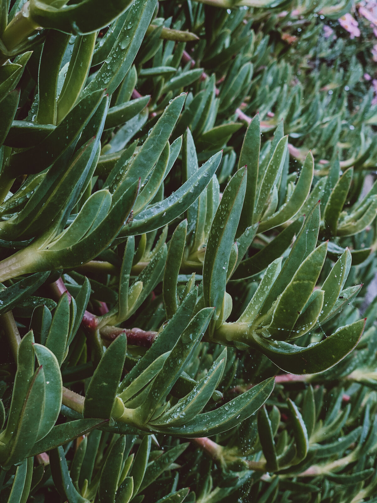
We recommend walking towards Lizard Point first to explore the old Lifeboat Station. This is a great spot to look out for seals, birds, and other wildlife. We were amazed by the number of succulents clinging to the vertical rock and the vibrant colour of the clear blue sea. You will find a café and some ice cream shops here. Lizard Point is the most southerly point of mainland UK.
Once you have finished exploring Lizard Point, walk back up and follow the path to the right, which heads towards the Lizard Lighthouse and follows the South West Coast Path. Please be careful not to wander off the path as the cliffs are unstable in some parts. You can see a large depression marked out.
Once you have finished exploring Lizard Point, walk back up and follow the path to the right, which heads towards the Lizard Lighthouse and follows the South West Coast Path. Please be careful not to wander off the path as the cliffs are unstable in some parts. You can see a large depression marked out.
Make your way to Housel Bay Beach, which glows turquoise when the sun comes out. There is a steep climb down to the beach via the path. We continued up the hill a little further and found a bench overlooking the Lizard Peninsula, where we ate our lunch before heading back to the car park.
You can also take a tour inside the lighthouse, which is currently running at reduced capacity due to COVID.

Old Lifeboat station at Lizard Point
Porthcurno to Porthgwarra
Length | 5.6km
walking time | 2 hours

Porthgwarra
We advise wearing suitable footwear, such as trainers or hiking boots, as there are thick brambles and gorse along this stretch. Park in Porthcurno car park and follow the signs to Porthcurno Beach. Once you arrive at the beach, take the path that heads up the cliff to the right and follow it until you reach the Minack Theatre.
Next to the café, the path continues along the coast. Follow it until you reach Porth Chapel Beach, and look out for St Leven’s Holy Well along the way. Continue on the coast path and you will arrive at Porthgwarra, a small fishing hamlet well known for appearing in the TV series Poldark. There is a café here where you can buy food and drinks. We enjoyed some tasty pasties, which we would recommend. There are also public toilets at this point.
We carried on a bit further to Hella Point, where you may spot the Cornish chough, Cornwall’s national bird.

Porth Chapel beach

Porthcurno

Porth Chapel beach
Loe Bar Beach, South Cornwall
Length | 6km
Walking time | Allow 2 hours

Loe Bar
If you want to witness the power of the sea, come to Loe Bar, but do not attempt to swim here. The area has a history of shipwrecks, with many vessels caught in vicious storms and falling victim to its force.
The large, mile-long beach holds back the water from the River Cober, forming a lake known as The Loe. It is Cornwall’s largest natural lake, offering peace and calm along its banks, with towering sycamore trees lining the edge. We were impressed by the diverse and hardy plants that cling to the sandbar.
We parked for free just past Chyvarloe Farm and began walking down the path towards Loe Sand Bar. We followed the bar, climbed the hill past Bar Lodge, and enjoyed incredible views across to Porthleven. If you have a National Trust membership, you can park at Penrose Estate instead. For a longer route, you can also walk around the lake.

Loe Bar

The Loe

The Loe