Having crossed the Minch back to Skye we planned where we wanted to go and what we wanted to do. A couple of years ago we spent a week on the island in an eco hut and it has become one of our favourite places in the UK. Originally we had planned to leave the ferry port and head along the west coast that day. With the weather being so good though and a little tired from the early ferry we decided to climb the easy trail up to Old Man Storr. It is an easy climb and the new trail makes it even easier. The car park has been expanded and we paid for 3 hours of parking which cost us about £3.
It is at a leisurely pace a 40 mile walk to the top. Skye has one of the most fascinating landscapes and the Storr is perfect evidence of that. With the Old Man Storr pointing skyward as a grand landmark that can be seen for many miles, a reminder that giants once used to live here, legend has it that The Old Man of Storr was a giant who once lived here. When he died he was buried and his thumb was left uncovered creating the iconic landmark. It does feel like it as well as you walk around such grand monuments of rock that look like they have been placed rather than a giant landslip that caused this unique landscape.
After an hour or so of taking photos and enjoying the view a few grey clouds rolled in and we decided to head back down to the van for some lunch.
A little further up the road is one of our favourite camping locations on Skye, the views out across the water to other islands and the mountains on the main land are enchanting. We actually parked here the night before catching our ferry across to the Isle of Lewis & Harris.
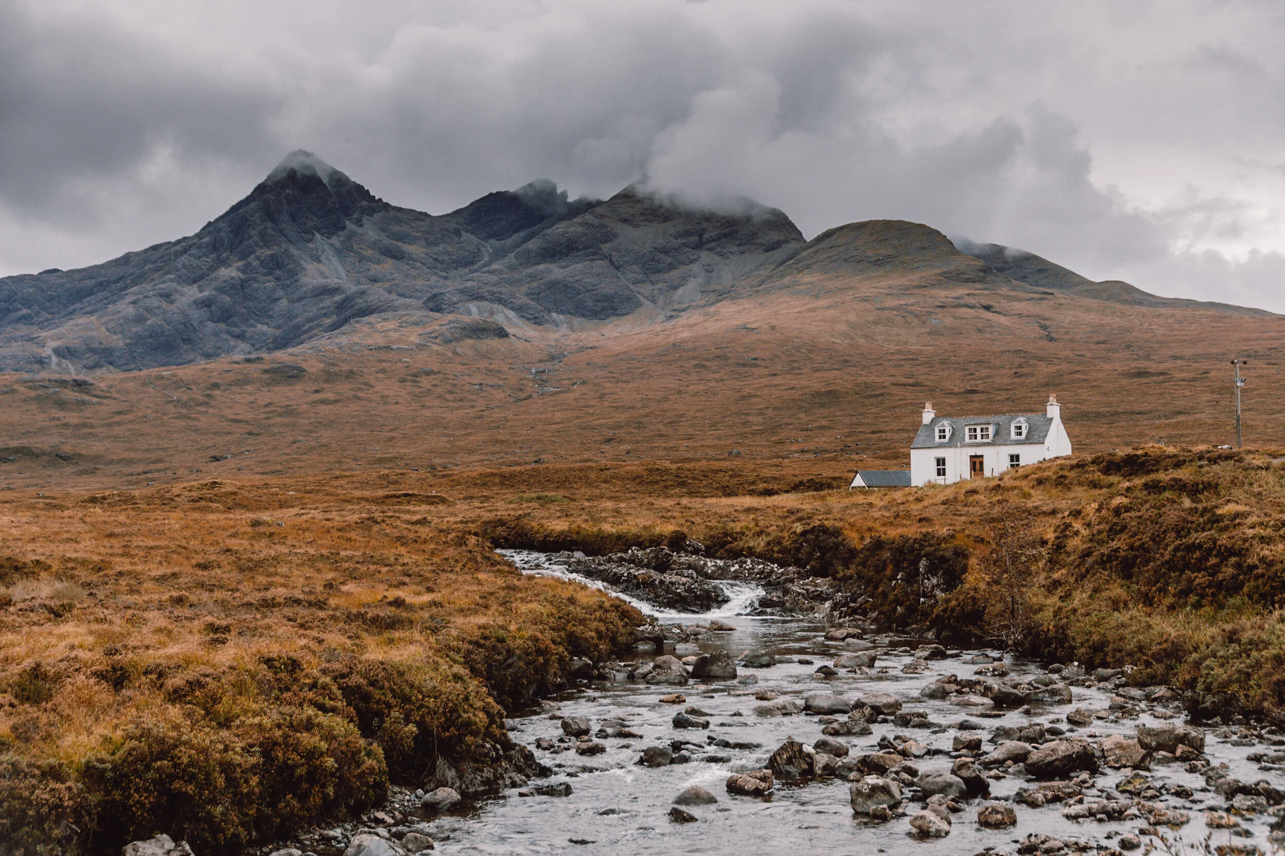
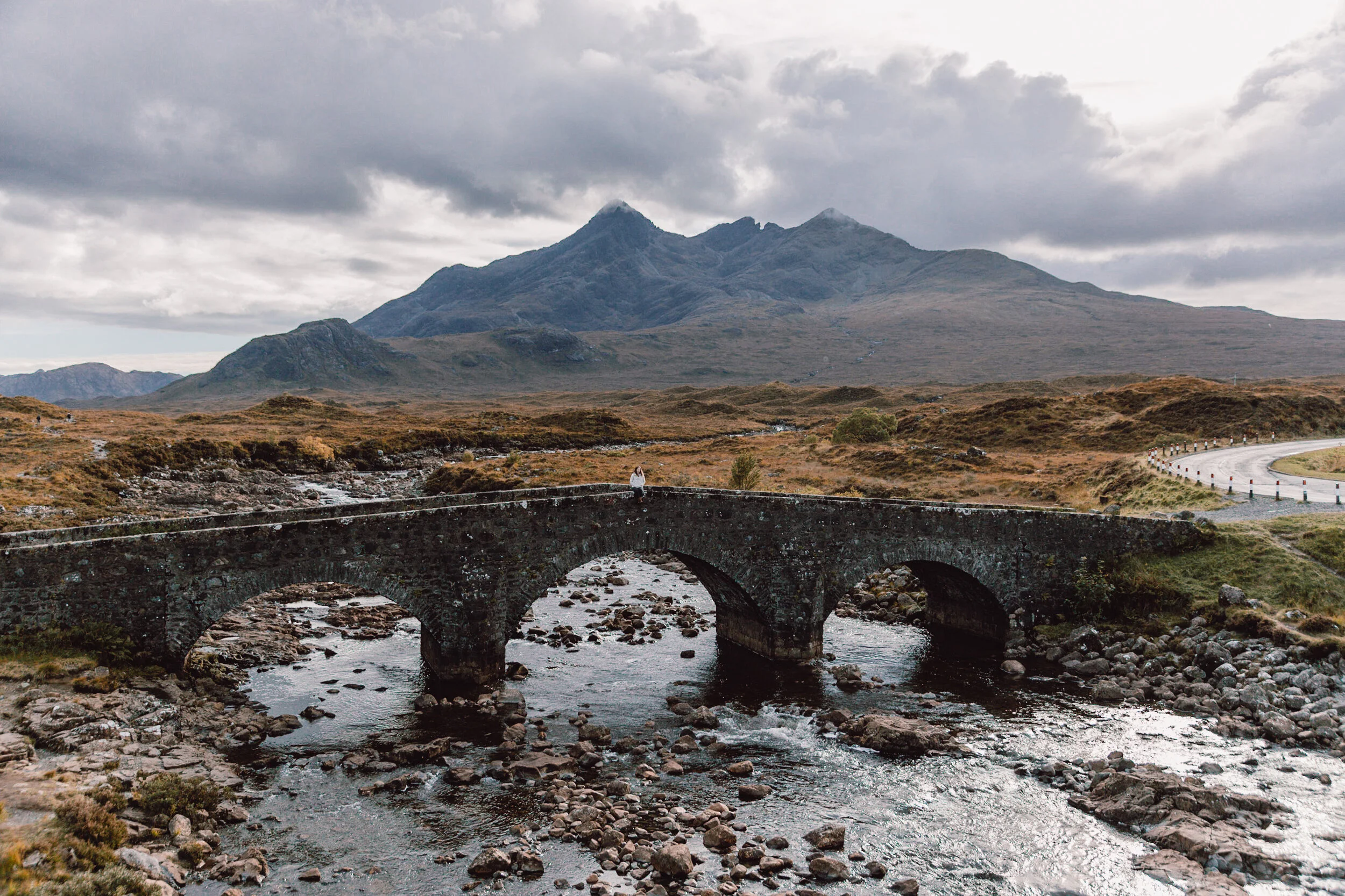
After filling our bellies we turned southwards towards Sligachan and more importantly Sligachan Old Bridge with a view of the Cuillin Mountains and 11 km black ridge of mountains consisting of 11 Munroes and 16 other summits. The tallest peak sits at 992 with 9 other peaks over 900 meters. There are hazards in these mountains that are only found here in the UK and the Cuillins are seen as the pinnacle of rock climbing in the UK. Regarded as the toughest and most challenging mountain range in the UK and sadly climbers have died even in recent years.
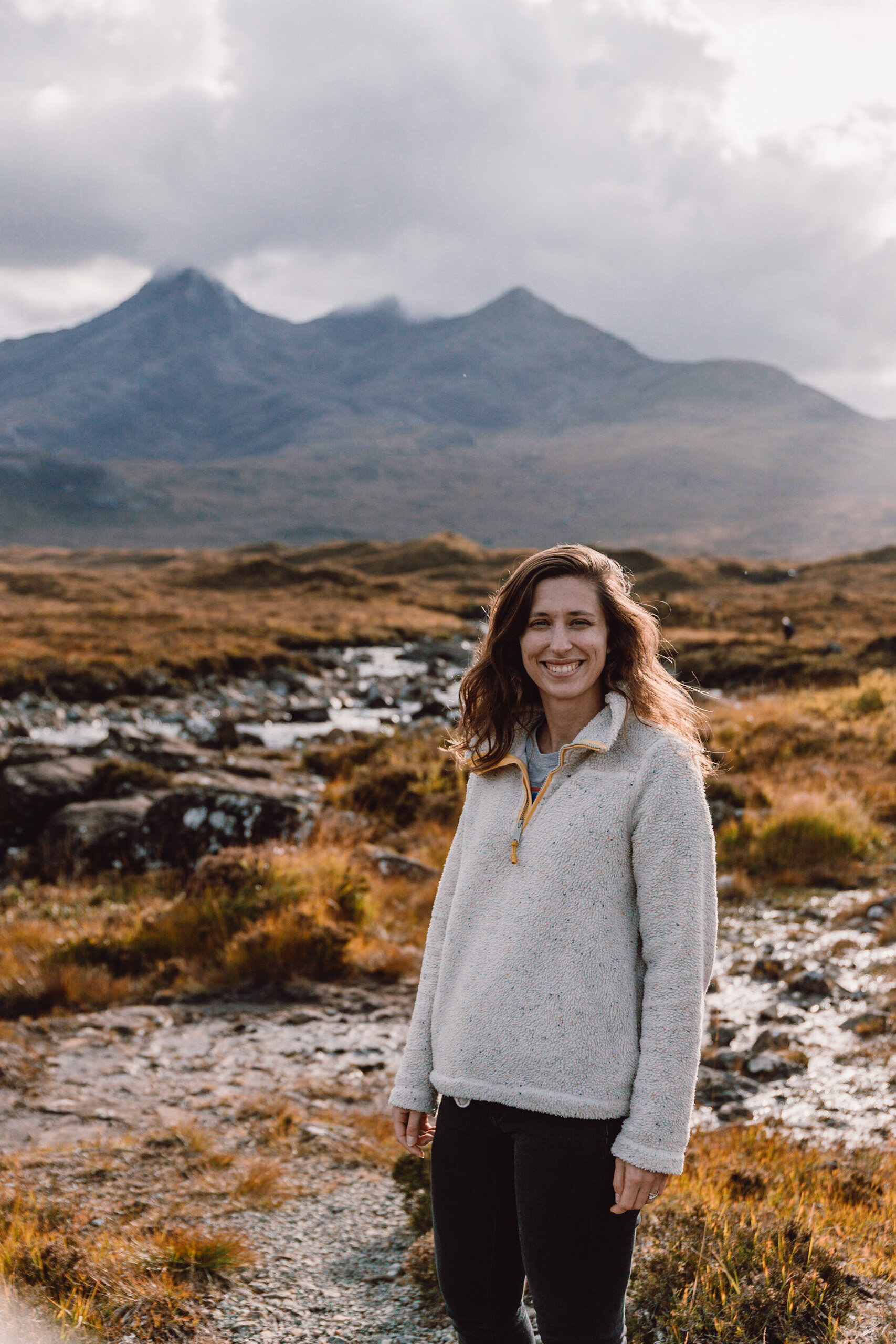
The last time we went to this bridge the mountains were covered in thick clouds and there was no view. We were much more lucky this time and we even had bright sun and blue skies as we rock hoped along the river and explored the area.
We walked a short distance along the road to explore a beautiful white house at the foot of the mountains and we decided we would be happy living here with this view and a cosy log fire. This is also the same road that leads to the fairy pools and that's where we drove to next. A local legend has it that a Clan chief married a fairy princess giving way to many fairy locations on Skye. When we last visited we were the only ones walking along the pools until one other couple showed up later and parking was free. This time we were surprised to see facilities under construction and a much bigger car park and the cost of £8 for a motorhome to park. We had noticed a much higher amount of visitors on the island compared to our last visit in 2017. We thought it could be the extra staycations due to Covid but the new facilities suggest that Skye is booming in popularity and the creation of the North coast 500 in 2015. Skye was increasing in popularity and a quick detour from the NC500 is a popular thing to do.
There is a lot of tension surrounding the NC500 route as the pressure from mass tourism on the locals and the environment is at an unsustainable level. We personally have decided to avoid doing the NC500 as we want to explore our own routes away from crowds that get stuck on the merry go round that is the NC500. Whether intended or not the NC500 has become an imagineless option for many to do as a tick the box project compelled to complete the 500 miles. For us getting stuck in a traffic jam in the Highlands is not what Scotland is all about. The NC 500 wasn't actually designed as a tourist trail; the issues extend far beyond the peaceful nature of the Highlands becoming very very busy and mountain rescue and other emergency services have been delayed getting to sites because of the sheer number of people crawling the tiny roads. We try our best to promote and live a sustainable travel lifestyle and as such we want to have as small an impact on an area and the communities that we visit.
We hiked down from the carpark to the fairy pools and past the groups that had gathered at the closest pools. We walked to the highpools which are less emerald in their appearance than the lower pools but just as beautiful. Last time we visited Hannah went for a little paddle under one of the waterfalls and I managed to persuade her to jump in again. She said it was very very cold!
The fuel light had pinged up on the van just as we pulled into the car park earlier and we had a 27 mile drive to the fuel station. The uphill climbs and winding roads meant that we would be burning fuel much quicker than a flat smooth road. The estimated miles left on the clock was 100 when we left the car park. Luckily we managed to find a lorry to draft behind and when we pulled up at the fuel station our dash had been reading a steady 30 miles left for at least 10 minutes or more.
After filling up we drove the short distance to our campsite for the night which we needed to plug in the van to charge our camera batteries and back photos up. We would be leaving the next day to head north west in the hut for beautiful beaches on the mainland.