This post may contain affiliate links, which means if you purchase through these links, we may receive a small commission at no cost to you. Thank you for supporting our website.
In Partnership with West Corsica. All opinions are our own.
As a destination, Corsica is at the heart of adventure in the Mediterranean, drawing in outdoor enthusiasts with its wide range of activities, including cycling, hiking, canyoning, kayaking, and diving. You are spoilt for choice with coastal walks, hiking routes and multi-day treks that scale the island's spectacular peaks, all rewarded with panoramic views.
The Capo Rosso Hike is one of the most beautiful coastal walks in Corsica, but it is not to be underestimated. This is a challenging, exposed hike with amazing views over the Scandola Peninsula, secluded beaches, and dramatic sea stacks. In our Capo Rosso hiking guide, we’ll share everything you need to know, including logistics, parking, difficulty, essential items, and why this hike deserves a place in your Corsica itinerary.
If you are planning a longer trip, this hike fits perfectly into a longer stay around the island. We have mapped out how to combine hiking, beaches and scenic drives in our 7 day Corsica itinerary, alongside a detailed best beaches in Corsica guide for the perfect Corsican adventure.
How to Use This Guide
Jump to any section using the Contents table below. Click a heading in the guide to pop back to the contents and explore other sections.

Distance | ~8 km
Duration | 4 hours with breaks
Starting point | Capo Rosso starting point car park
Ending point | Capo Rosso starting point car park
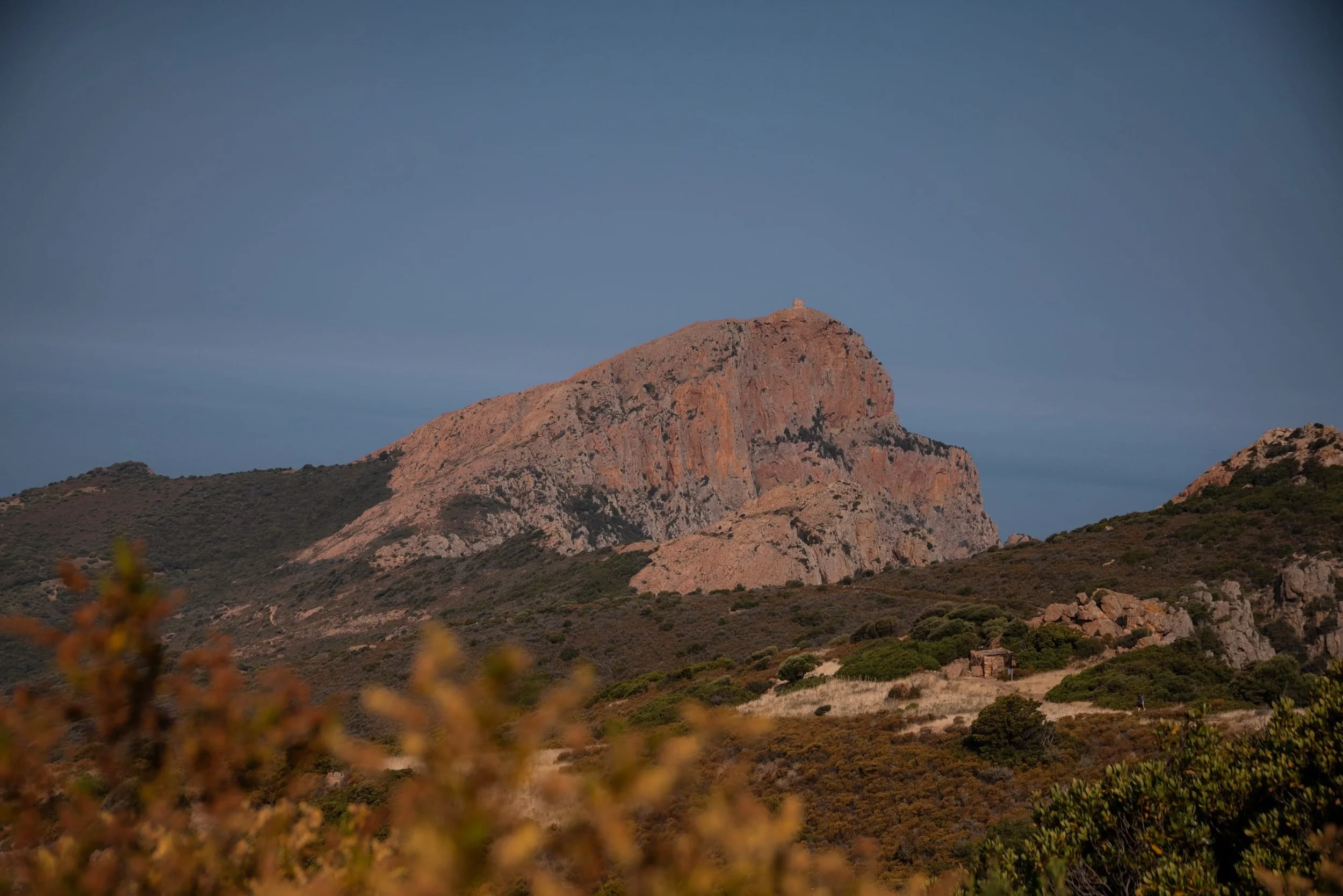
Highest point | Tour de Turghiu (Genoese Tower) at 335 metres
Elevation gain | ~450m
Route type | Linear
Difficulty | Moderate to hard (due to heat, exposure & steep final climb)
Best time of year to hike| Spring (April to June) and Autumn (September to October). Outside these months, the trail can be extremely hot in summer and less pleasant in winter.
The Capo Rosso hike is one of the most popular hikes on the island, with a feast for the senses and a must-visit for any Corsica itinerary. Here’s why you should take on the Capo Rosso Hike:
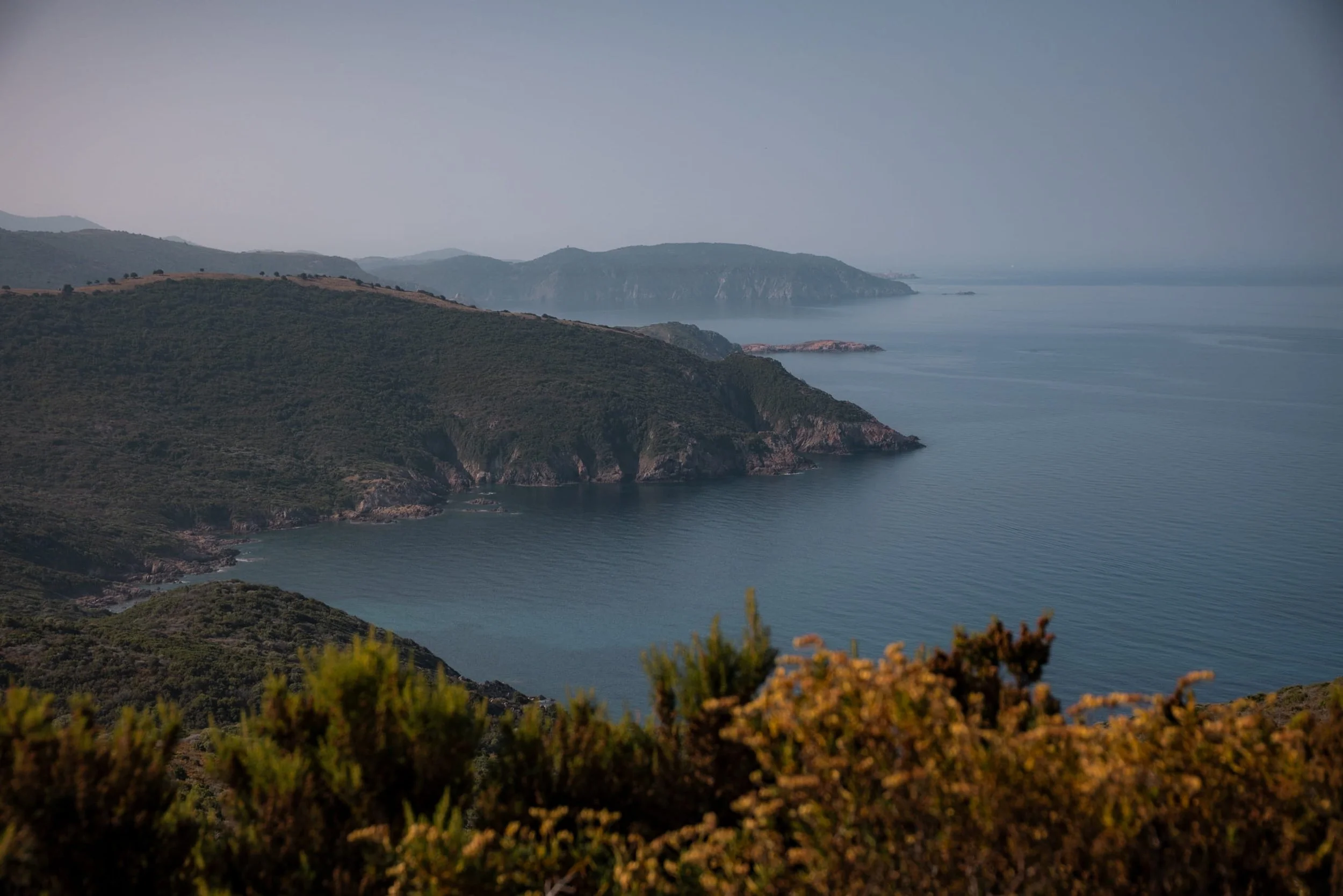
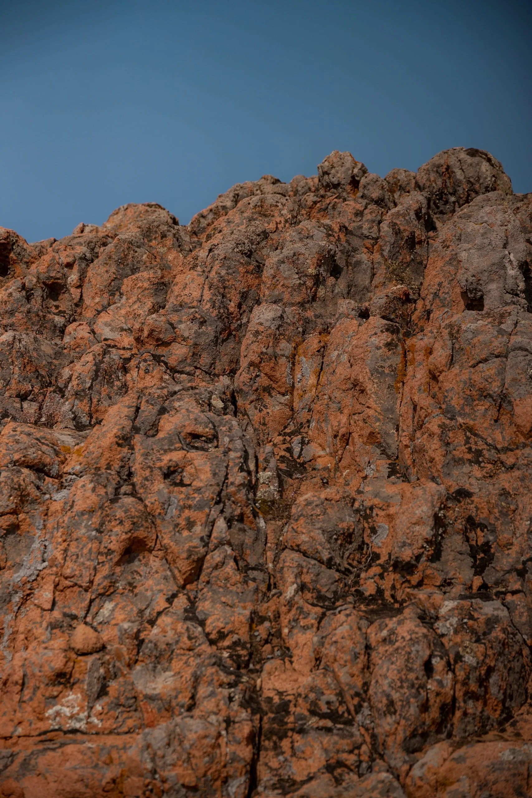
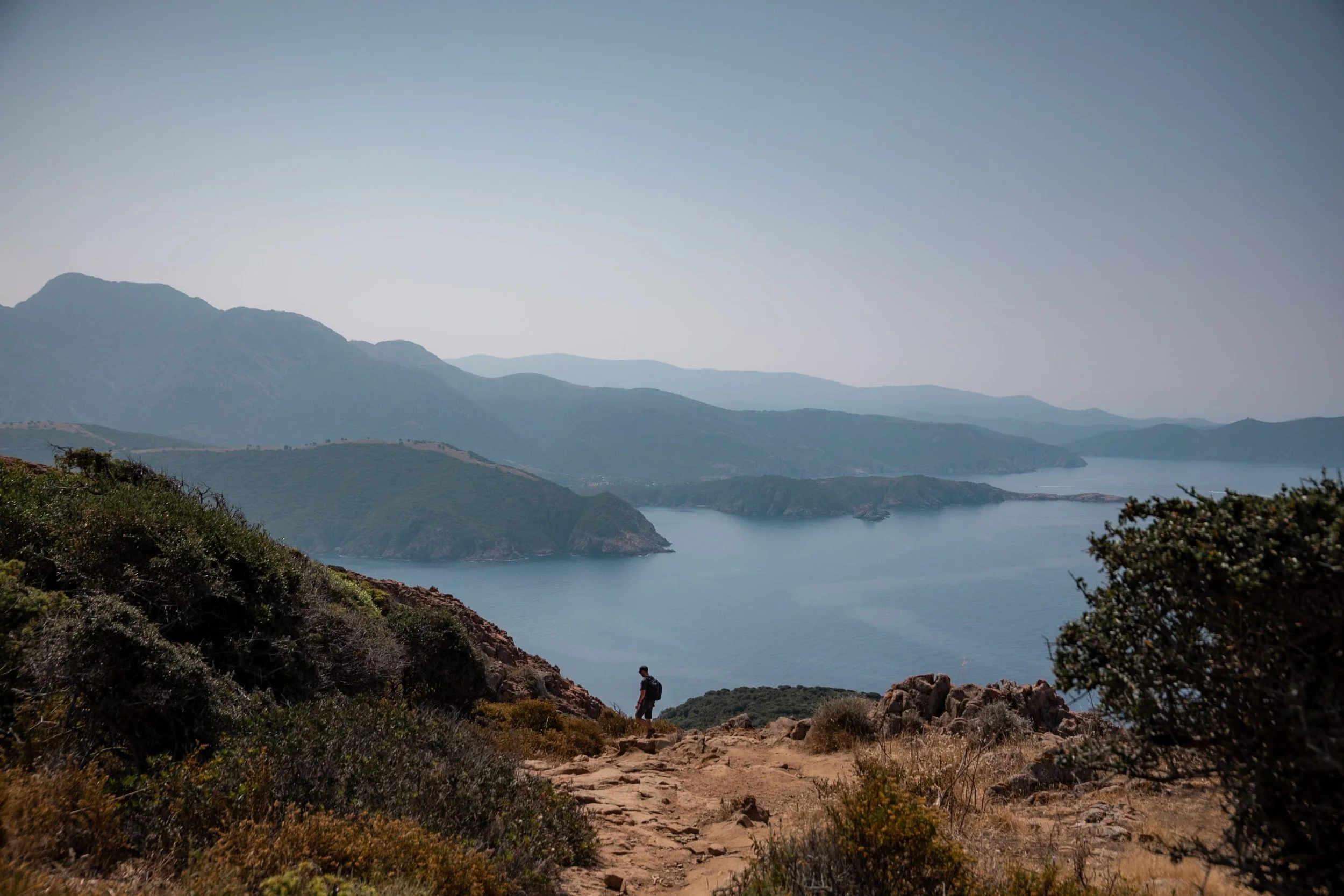
Dramatic coastal scenery - Red and pink granite rocks create a striking contrast against the deep blue Mediterranean, making every corner picture-worthy.
UNESCO World Heritage Site - The trail lies within the Gulf of Porto, recognised for its breathtaking landscapes and protected natural beauty.
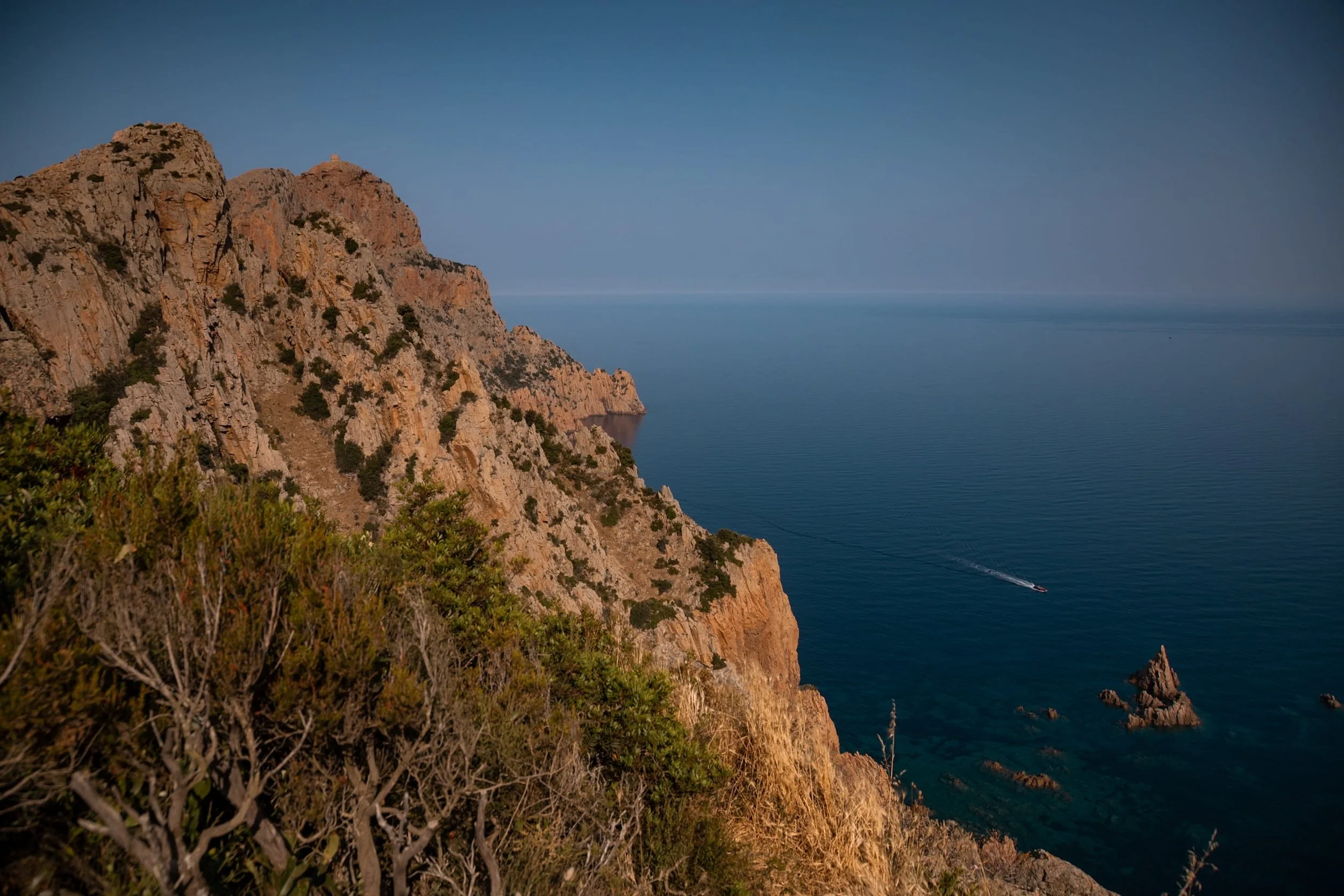
Towering sea cliffs - Some of Europe’s highest cliffs rise over 300 metres, presenting unique viewpoints across the island.
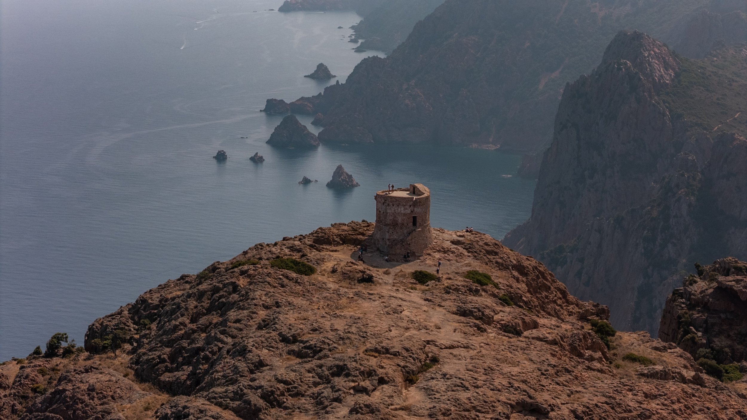
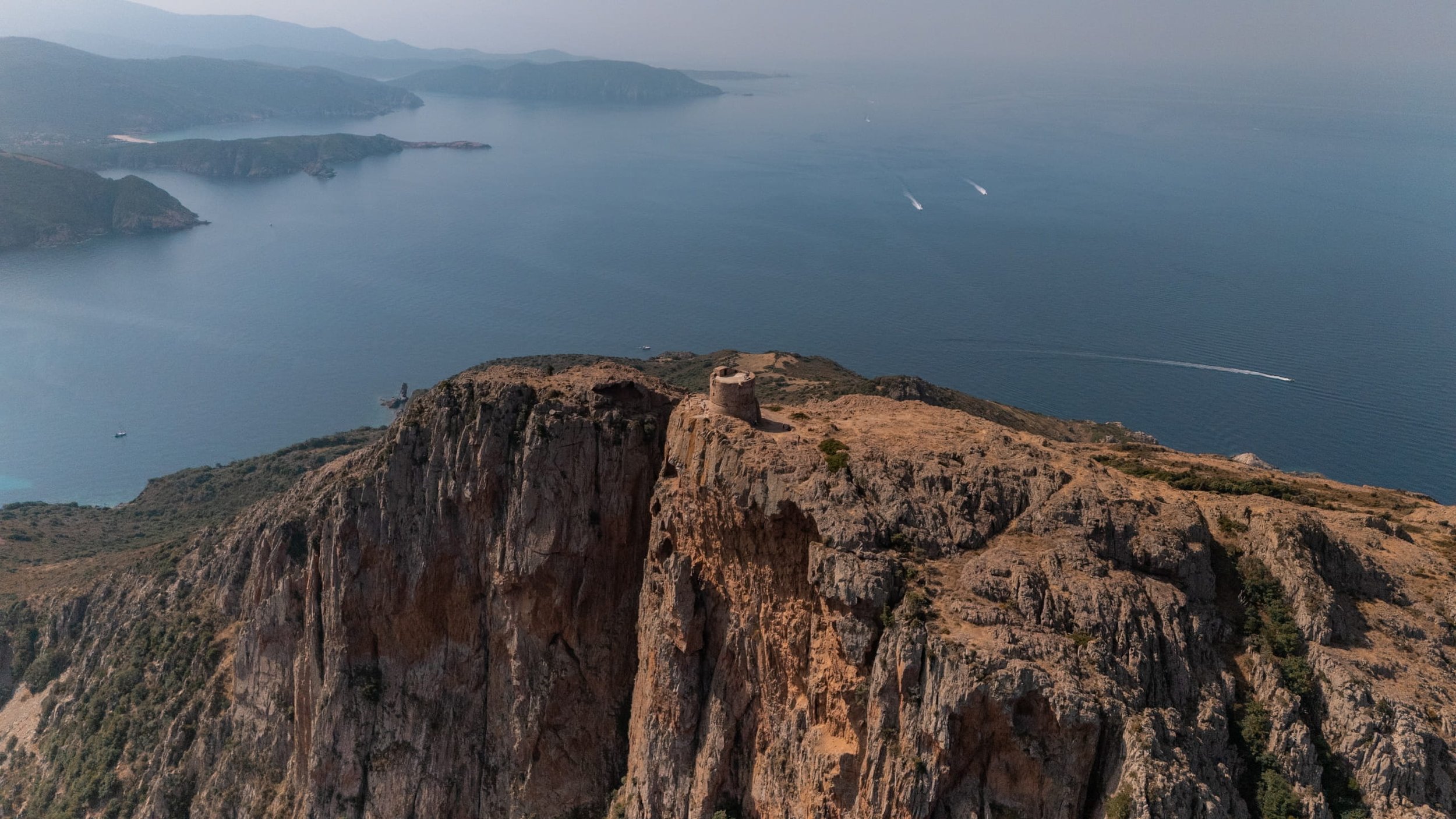
Historic Genoese tower - The 17th-century Tour de Turghiu marks the summit, adding a touch of history to your adventure, and it makes you wonder how they managed to build it in such a remote location.
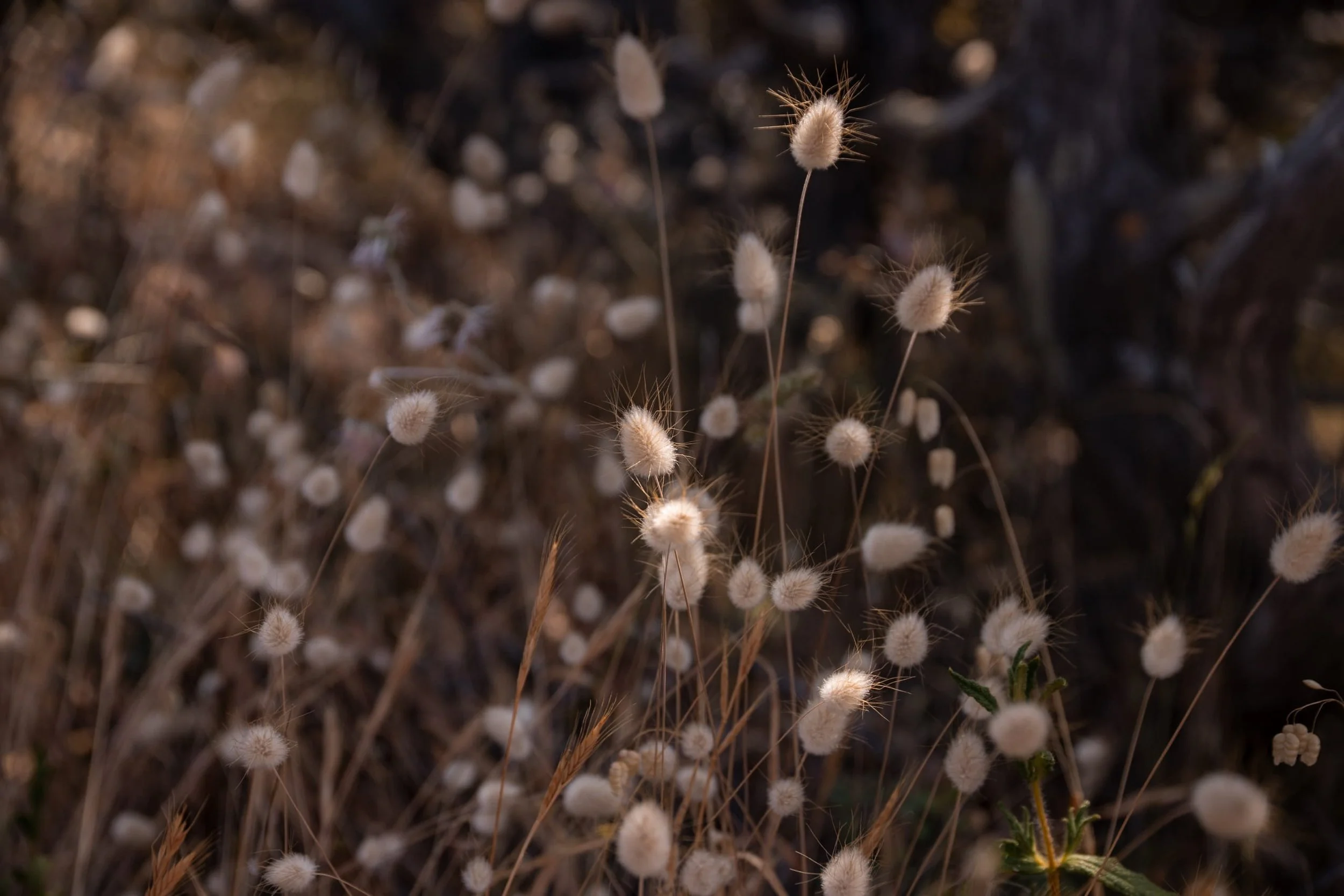
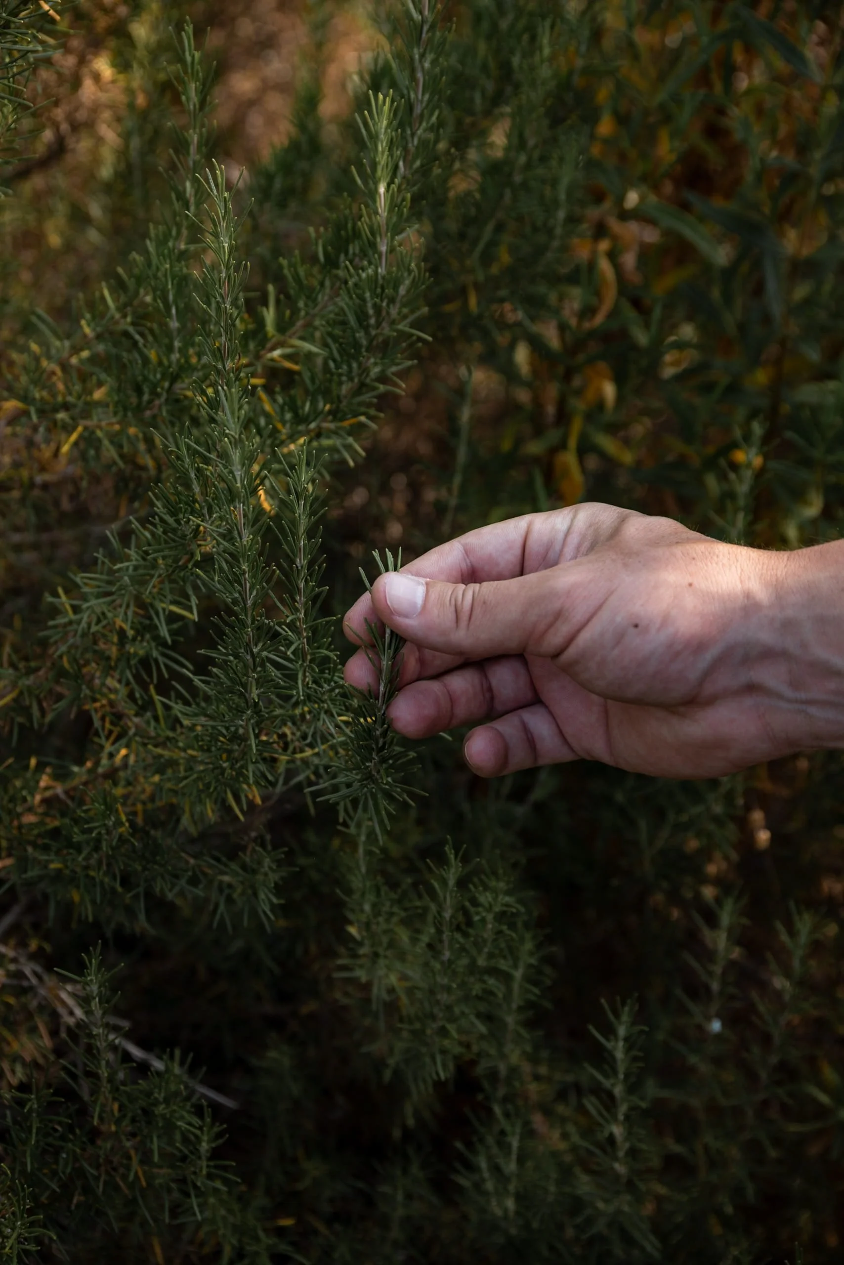
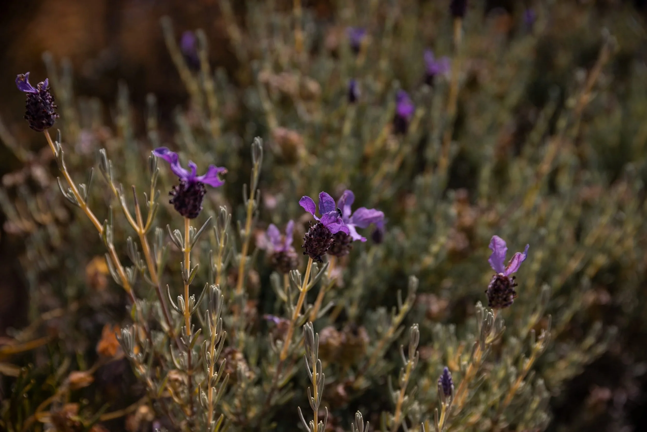
Unique Corsican flora - The trail winds through maquis, the hardy coastal shrubland filled with aromatic herbs and flowers, including lavender, rosemary, curry plant (bright yellow in summer), myrtle, and more. The fragrance of these essential-oil-rich plants fills the air as you hike.
Wildlife encounters - Keep an eye out for buzzing bees, wild goats, ospreys (nesting on the nearby Scandola Nature reserve) and the occasional lizard darting across the path.
Accessible yet rewarding - The trail is easy to follow all the way to the summit, making it a challenging but achievable hike for those prepared and with a good fitness level. It is also suitable for children over 7 years old, making it a family-friendly option.
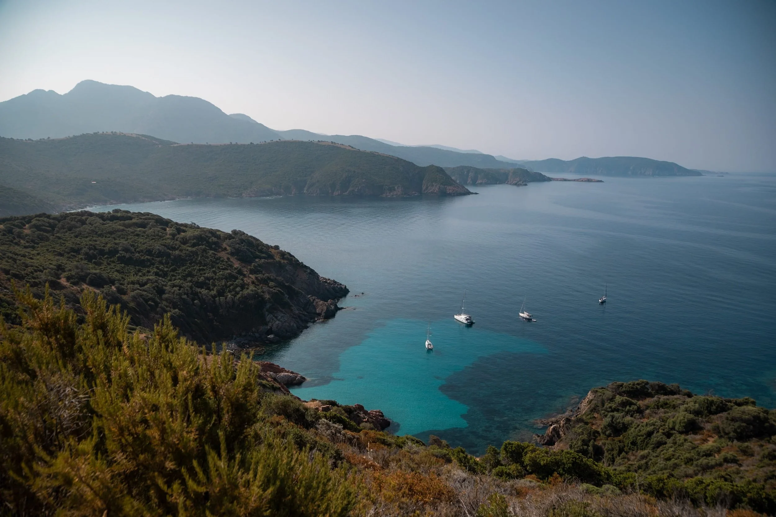
Panoramic views - From the top, on a clear day, you can see across to the Scandola Nature Reserve and the southern part of the Gulf of Porto, taking in some of Corsica’s most iconic coastal sights.
We hiked Capo Rosso in early June, and by midday the temperatures were already climbing above 30°C, making it essential to start early to avoid the heat.
The trail was warm but manageable, with herbs and wildflowers in full bloom, and there were fewer crowds than during peak summer.
For the best experience, aim for spring (April to June) or early autumn (September to October) and leave early in the morning. Summer (July and August) can be extremely hot, especially on the exposed sections and the final climb to the Genoese tower. Winter (November to March) is cooler and quieter, but rain and slippery sections can make the trail more challenging.
We came across several hikers who had started later in the day. On our way back, we found a couple really struggling in the heat without enough water. The man was desperately seeking shade in the bushes and showing signs of mild heatstroke, and we were able to offer him some water as we passed.
The starting point for the Capo Rosso hike is located between Piana and Plage d'Arone. There are a few information boards at the beginning of the route, and you can download the AllTrails Capo Rosso hike map to plan your stops and record your walk.
From Piana | Take the D81 and then turn onto the D824 towards Arone. The road is fully tarmacked, with several viewpoints overlooking the Gulf of Porto along the way. You’ll find a large, uncovered car park on the right, next to a café building, which marks the start of the hike.
From Ajaccio or Cargèse | You will be directed through Piana, as there is no coastal shortcut to Arone Beach. The hike can only be accessed from Piana or directly from Arone Beach.
Plan your next adventure
If you book through our links, you help support our website at no extra cost to you - thank you!
Bring plenty of water - The trail is mostly exposed, with very limited shade along the way. Plan to carry enough to stay hydrated throughout the hike, for example, 1.5 to 2 litres per person.
Plan a lunch/snack stop - We stopped at the old farming building just before the final climb to the Genoese tower. There’s some shade here, making it a perfect spot to rest and refuel.
Be fit enough - The Capo Rosso Hike is challenging with steep sections, loose rocks, and exposed paths, especially when combined with the heat. Make sure you have a good level of fitness before attempting it.
Protect yourself from the sun - Bring a hat to keep your head cool, sunglasses and suncream to avoid sunburn.
Wear sturdy footwear - Teva sandals or flimsy shoes aren’t the best choice for this hike, especially on the uneven rocks of the ascent and in hot conditions. Sturdy trainers or hiking boots are much better.
Don’t hike alone - If you do decide to hike solo, make sure someone knows where you’re going and when you plan to return.
Parking is free - There is no charge to park at the starting point of the hike. We would suggest treating yourself to a well-earned cold drink at the café afterwards and taking a moment to reflect on how far you’ve come once you complete the hike.
No facilities on route - Be self-sufficient as there are no facilities such as toilets, water points or shops on this hike. The only facilities are at the café found at the beginning of the hike.
Respect nature - We noticed that parts of the lower path were closed to allow the vegetation to recover, which really highlights how fragile this landscape is and why it’s UNESCO protected. Stick to the marked paths, respect any closures, and avoid picking flowers or plants. The maquis vegetation is hardy but slow to recover, and leaving it untouched helps preserve the natural beauty of this coastline for future hikers.
Landscape and geology of Capo Rosso
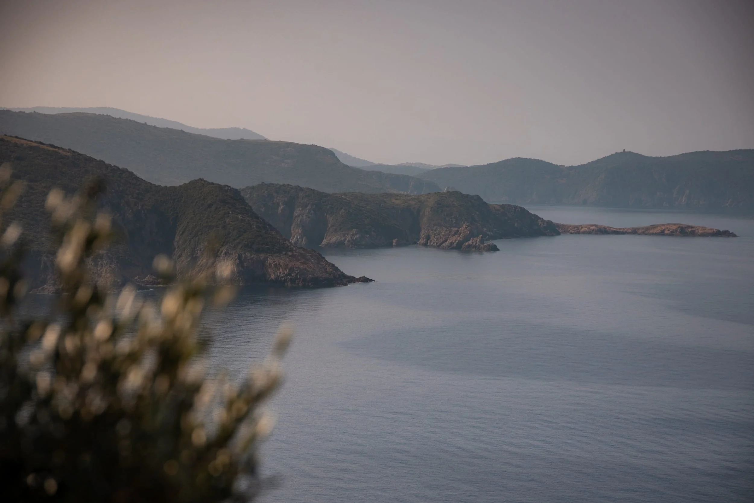
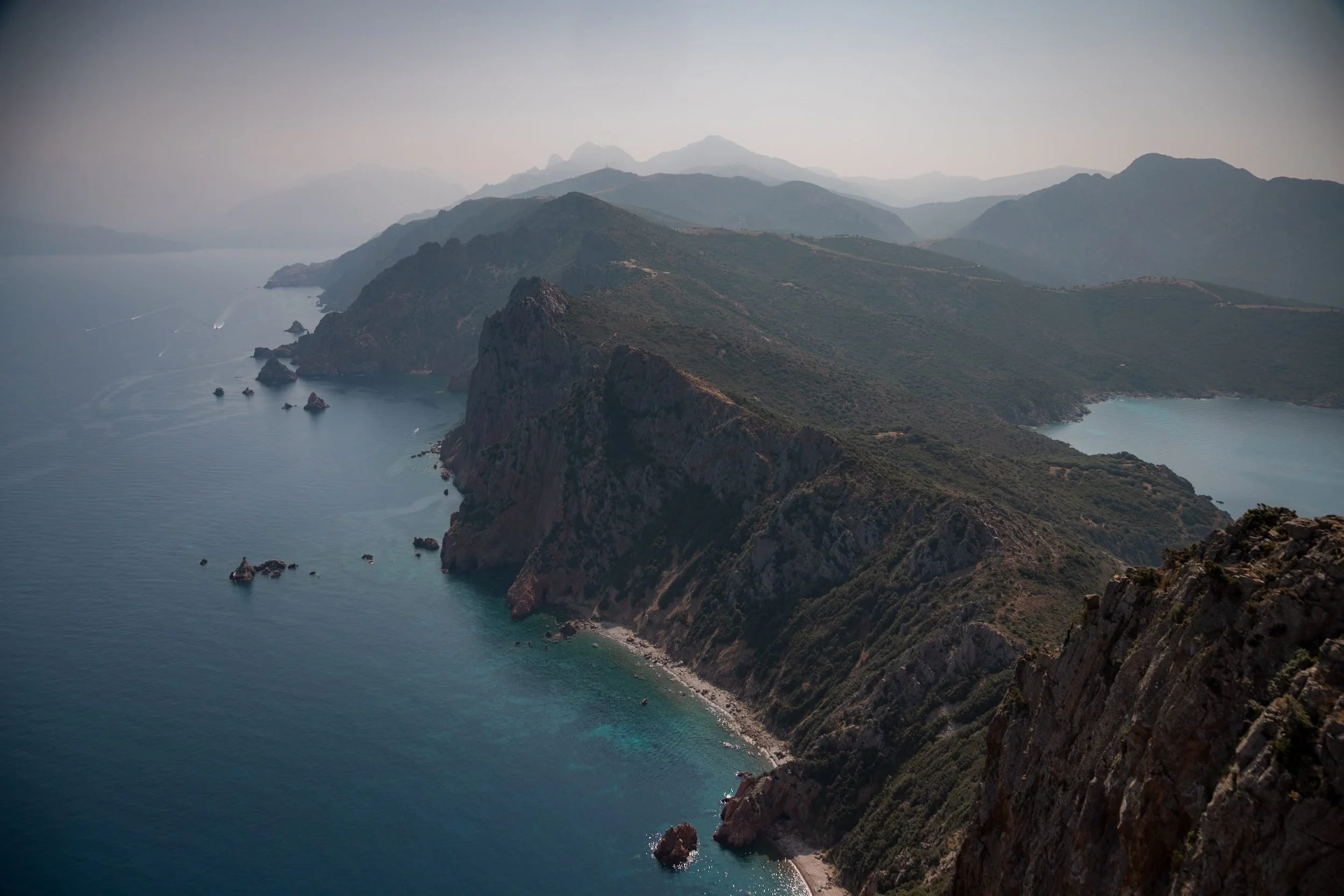
Before you even set off, take a moment to look around. Capo Rosso juts far into the sea on the west coast of Corsica, just south of the Gulf of Porto. Immediately, you can see the difference between the north and south sides.
To the north, cliffs of deep red and pink granite plunge straight into the sea, dramatic and raw, with jagged little islets scattered below. The mineral-rich granite catches the sunlight beautifully, glowing in shades of rust and rose, and it really makes you appreciate how wild this coast is.
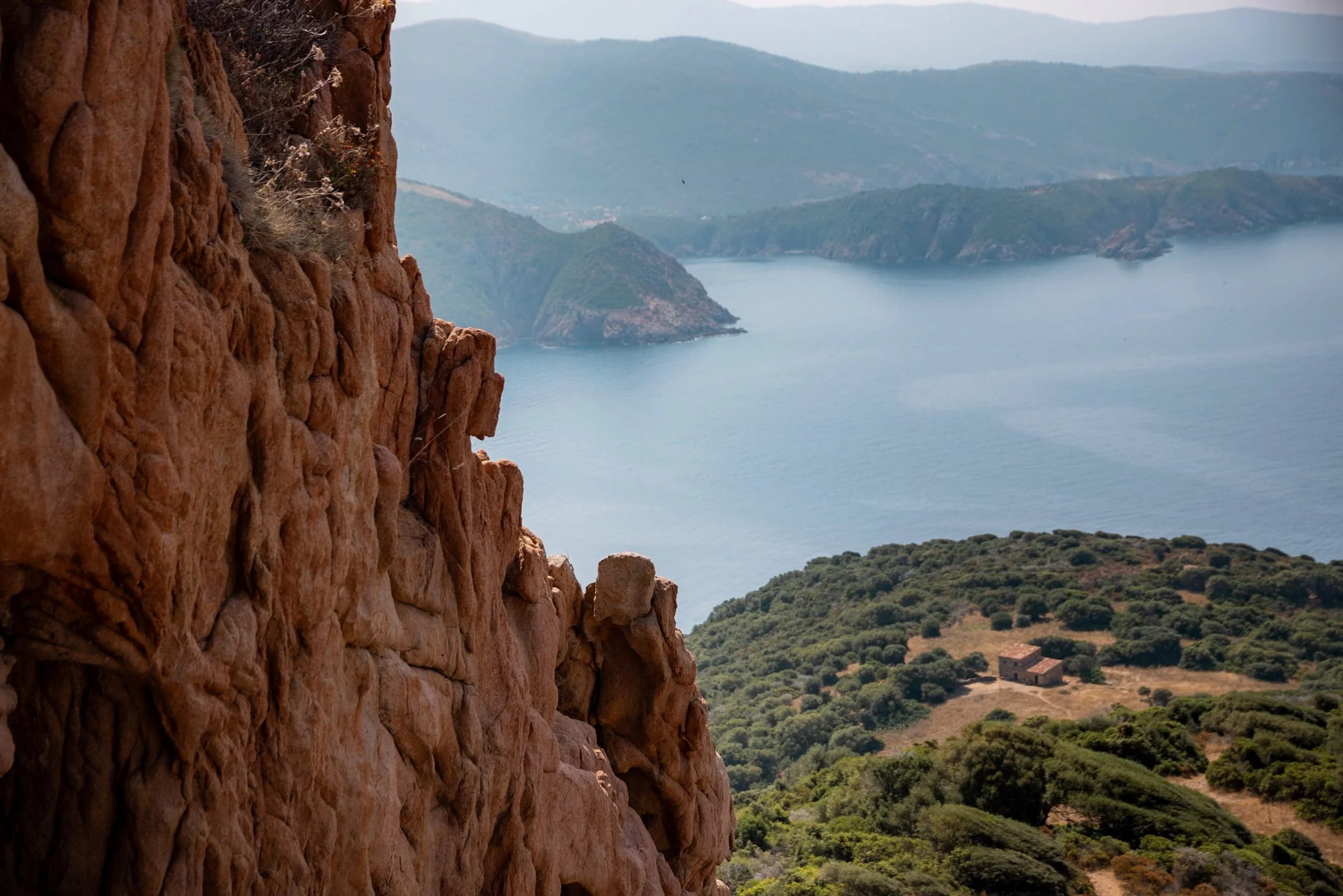
To the south, the slopes are gentler and greener. Long ago, these hills were farmed, and if you look closely, you can spot old terraces and tiny stone buildings peeking through the maquis. The softer rock here has allowed the land to be shaped by both nature and people over centuries, giving it a calmer, more cultivated feel compared with the rugged north.
Starting Out
The hike begins at the large car park on the road from Piana to Arone Beach, on the right-hand side. Here you will also find the A Guardiola bar or café, which looks out across to Capo Rosso.
From the car park, the Capo Rosso hiking trail starts as a mostly dirt track, winding through Corsica’s fragrant maquis vegetation. On a clear day, you can see your final destination, the Tour de Turghiu, from the starting point. There are a few information boards along the way giving details of the route and some of the local wildlife you may spot.
There is very little shade in this first section, so make sure you wear a hat and stay hydrated. Early morning is the best time to start, to avoid the midday heat. Most of this first section is gentle downhill, making for a relatively easy warm-up before the steeper climbs later in the hike.
Wildlife along the Capo Rosso Trail
Look out for lavender, rosemary, curry plant and thistles along the path. Their aromas fill the air and give the Corsican landscape its distinctive character. This unique vegetation, known as maquis, also influences the flavour of local honey if you get the chance to try some.
Keep your eyes on the skies as well as the path. Pale swifts and white-bellied swifts skim the ridgelines at astonishing speeds, while ospreys nest on rocky outcrops along the coast. To protect these birds, it is essential to stay on the marked paths and avoid disturbing nesting areas.
The cliffs and islets are also home to endemic plants found only in Corsica and Sardinia, including Corsican stork’s bill and tree spurge, a Mediterranean species adapted to heat and coastal winds.
Parts of the trail may be temporarily closed for wildlife conservation. These closures are in place to protect sensitive species, and disturbing protected wildlife can result in fines under Corsican environmental law. Respect closures, stay on marked paths, and leave no trace of your visit.
First Lookouts
After a short while, you will reach some steps and a small lookout on the right. This is your first chance to enjoy views of the Gulf of Porto and the hidden coves below with their shallow, clear waters. The path continues along the dirt track with loose rocks in places, so take your time and watch your footing.
You will also pass a small water fountain, though it is best not to rely on it as your main water supply. The lower path is closed to allow the vegetation to recover, so make sure you stick to the marked route.
Aghja Rest Stop
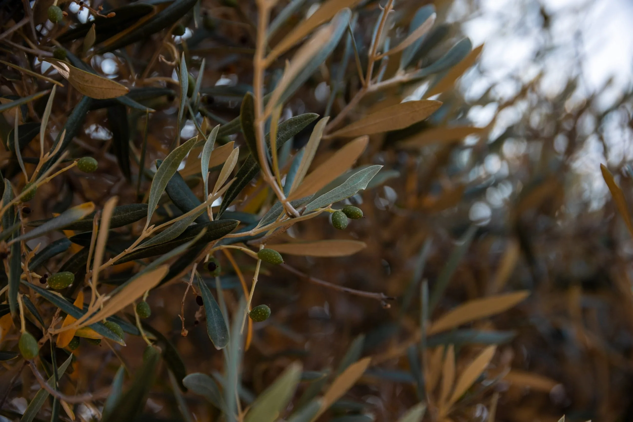
After about an hour, you’ll reach Aghja, l’aire de battage du blé. You are walking through the remains of Capo Rosso’s agricultural past. Hidden among the maquis are ancient terraces once used to grow barley and wheat during the 19th and early 20th centuries.
Dry stone walls, threshing floors, fountains, olive groves and small stone houses tell the story of a time when families worked these hillsides. Depending on the season and the household, these buildings were used as shelters when working the fields, for storing grain and straw, tending flocks of goats or sheep, or even making cheese.
One of the region’s most famous products, Brocciu de Chèvre de Piana, was traditionally made from warmed whey and remains one of Corsica’s most celebrated cheeses today. This is an excellent spot to rest and have a snack before the final climb.
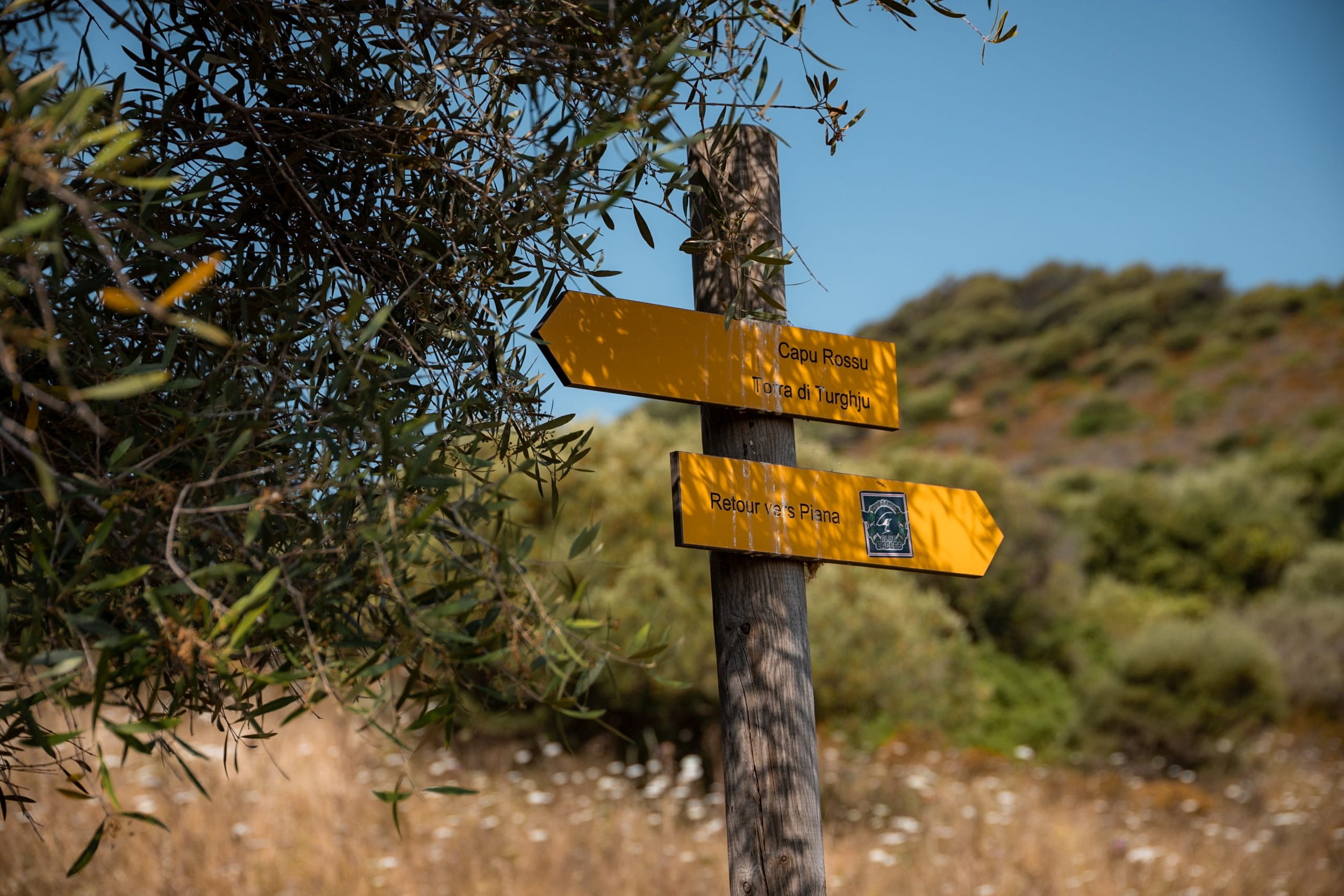
This part of the trail can be a little confusing, but the first section is well signposted with yellow markers showing the time to the next point.
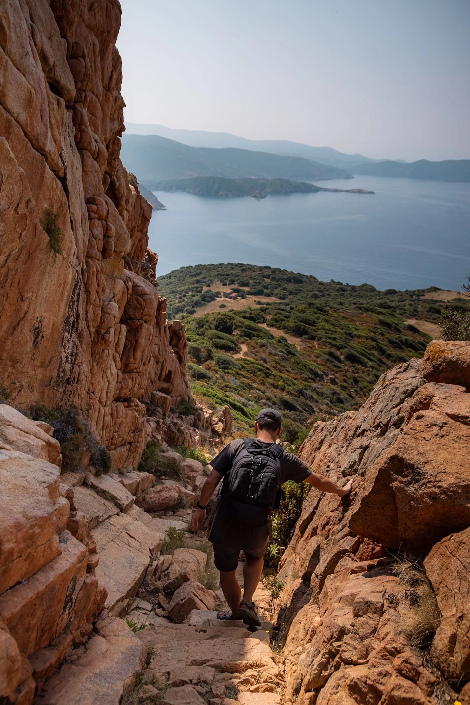
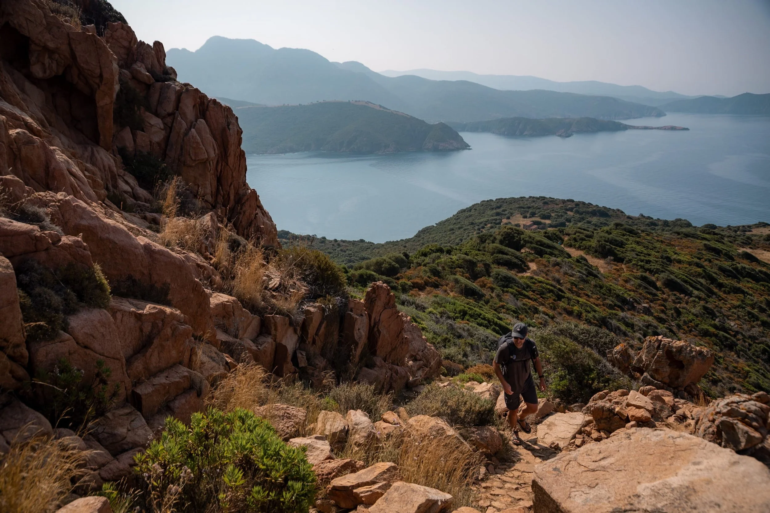
The Final Climb
After Aghja, the Capo Rosso trail becomes noticeably steeper, with loose rocks and exposed sections leading to the summit. The first part of the climb zigzags up the slope, and later the path is marked by small piles of rocks. It is a challenging ascent, so take a steady pace, do not rush, and make the most of the last bit of shade before you are completely exposed all the way to the top.
The sun and heat here can be intense, so make sure you have plenty of water and a hat. By the time we reached the summit, our bodies felt like we had been hiking in a sauna. Bringing a light layer to change into and cool down is a good idea.
The final stretch to the Genoese tower takes around 40 minutes. This is the most exposed section of the hike, so take breaks as needed and watch your footing. Sturdy footwear is essential to traverse the loose rocks safely.
Reaching the Genoese Tower
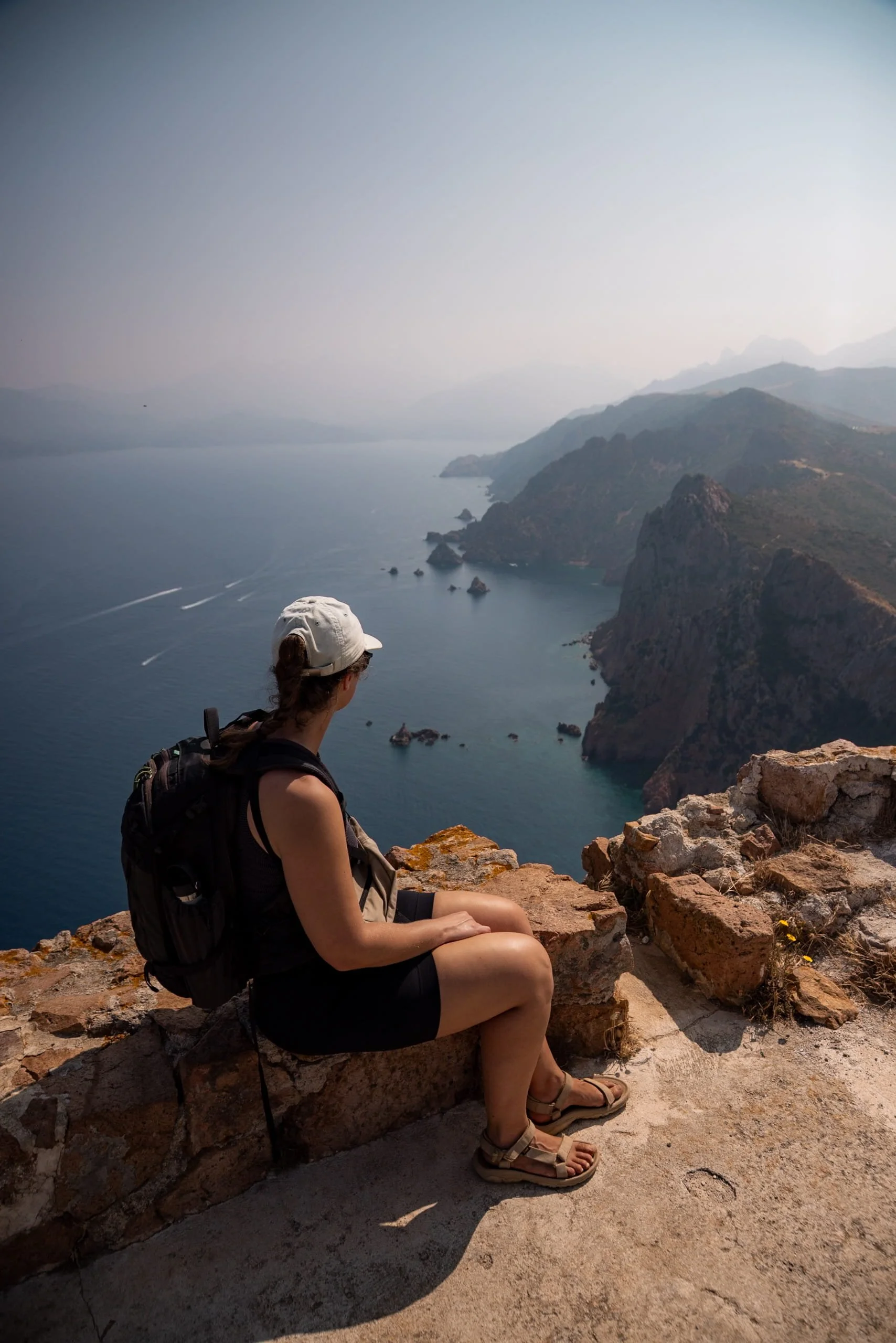
The 17th-century Genoese tower, Turghiu, marks the summit at around 335 metres. Capo Rosso offers some of the best views in western Corsica. To the north, the evening light catches the Calanches of Piana and Scandola.
On a clear day, you can spot Monte Cintu, and looking from the tower, you can spot secluded beaches, dramatic sea stacks, and the southern part of the Gulf of Porto.
Make sure to go inside the tower and take a moment in the welcome shade. Then climb the outside steps for an unbeatable view of the west Corsican coastline and landscape. It is a perfect spot to pause, take photos, and soak in the scenery before beginning the descent.


The Descent
Heading back is mostly downhill at first, but the final 20 minutes involve a short ascent before returning to the car park. Loose rocks and gravel make the descent tricky, so take it slow and watch your footing. You will follow the same path back, so it should be easier to navigate your way back.
We passed a few hikers who had started later in the day and were struggling with the heat. Always remember to carry plenty of water, wear sun protection, and don’t push yourself.
Finishing Line
Back at the car park, the bar is a welcome sight. Treat yourself to a refreshing drink (you deserve it!) and take a moment to reflect on the hike and the incredible views you’ve enjoyed.